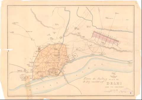
Plan of Delhi and its Environs


Section: Maps, plans and nautical charts
Uniform title: NUEVA DELHI (India). Planos de población (189). 1:22000
Title: Plan of Delhi and its Environs / Drawn & Engraved by Edwd. Weller Duke Street Bloumsry
Material or type of resouce Area: Escala [ca. 1:22000], 1 mille [= 7,5 cm]
Publication: [London?] : Weckly Dispeth 139 Flet St, [189-?] (London< : Day & Son Lith. to the Queen)
Physical description: 1 plano : col. ; 32x44 cm en h. de 34,5x49 cm
Content type: Imagen cartográfica
Media type: computadora
Carrier type: recurso en línea
Notes: En : 'Weekey Dispatch'
Relieve representado por sombreado
Procede de la 'Colección Rico y Sinobas' n 2
Materia / lugar / evento: Planos de población
S.XIX
Other authors: Weller, Edward
Day & Son
Weekly Dispatch Atlas
UDC: 912:314(540 Delhi)'1890/1899'(084.3)
540 Delhi
Type of publication:
 Maps
Maps
Rights:
Préstamo:
 Disponible
